Submitted Article —
The National Weather Service in Wakefield, Va., has issued a briefing for the watch area, which includes the Eastern Shore of Virginia.
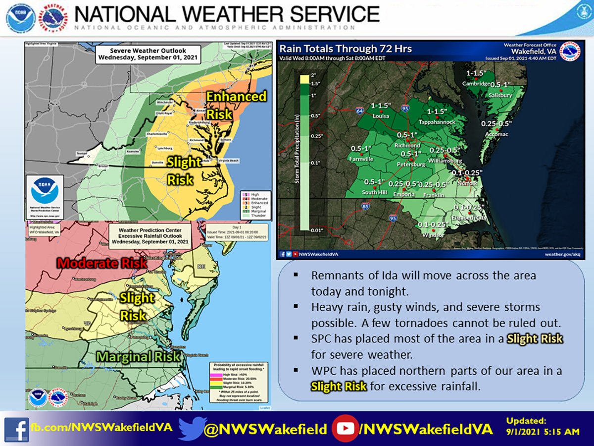
Threats: Showers and thunderstorms associated with the remnant low of Ida will cross the area this afternoon and evening. The primary threats will be damaging winds and localized heavy rain. However, isolated tornadoes cannot be ruled out.
Location: Central/South Central Virginia, Tidewater/Eastern Virginia, Hampton Roads, Maryland/Virginia Eastern Shore, and Northeast North Carolina. The highest risk is over the lower Maryland Eastern Shore.
Timing: 1 p.m. to 8 p.m. over the Piedmont, 4 p.m. to midnight along the coast. The threat will end as a cold front moves offshore after midnight.
Overview and Impacts:
- Strong to severe storms could result in areas of 50-70 mph wind gusts. Over the Bay and coastal waters, winds of 40-50+ kt are possible with the storms.
- Heavy downpours will be possible, allowing for some locations to pick up over 1 inch of rain in a short period of time. This could result in minor flooding of urban/poor drainage areas.
- The bulk of the activity occurs this afternoon and evening. Everyone is urged to stay weather aware and have multiple ways to receive warnings.
Check Links Below For Updates: