")
Staff Report —
The National Weather Service in Wakefield, Va., this morning issued a briefing for possible severe weather later today.
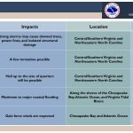
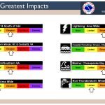
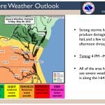
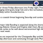
Threats: A warm front lifts north across the region which will allow for strong to severe thunderstorms to develop late this afternoon into tonight. Damaging wind gusts, large hail, and heavy rain will be possible with the strongest storms. A few tornadoes cannot be ruled out, especially along and south of Interstate 64.
Location: All of the area has the potential to see severe weather, but the greatest threat is roughly along and south of Interstate 64.
Timing: Late this afternoon into tonight (3 p.m. to 11 p.m.)
Overview and Impacts:
- Localized downed trees, power lines, and isolated structural damage associated with the strongest storms. Large hail is also possible.
- A few tornadoes are possible, especially along and south of Interstate 64.
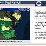
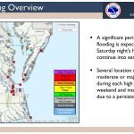
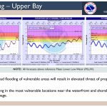
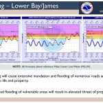
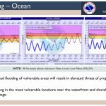
- Rain will be heavy at times. This could result in minor flooding of urban/poor drainage areas.
Click on the first image below to access the slides.


Check Links Below For Updates:
Questions?
Call NWS 757-899-5734
@NWSWakefieldVA facebook.com/