Staff Report —
The National Weather Service Wakefield, Va., has issued a briefing highlighting the heat threat for today, Wednesday, July 6, as well as severe thunderstorm risk areas for today, Thursday, and Friday.
Overview and Impacts:
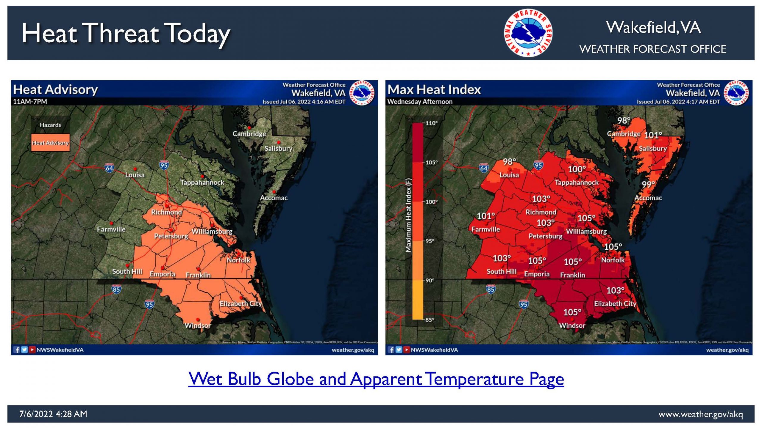
- Heat indices are expected to approach 105 degrees this afternoon across much of central, southern, and southeast Virginia and northeast North Carolina.
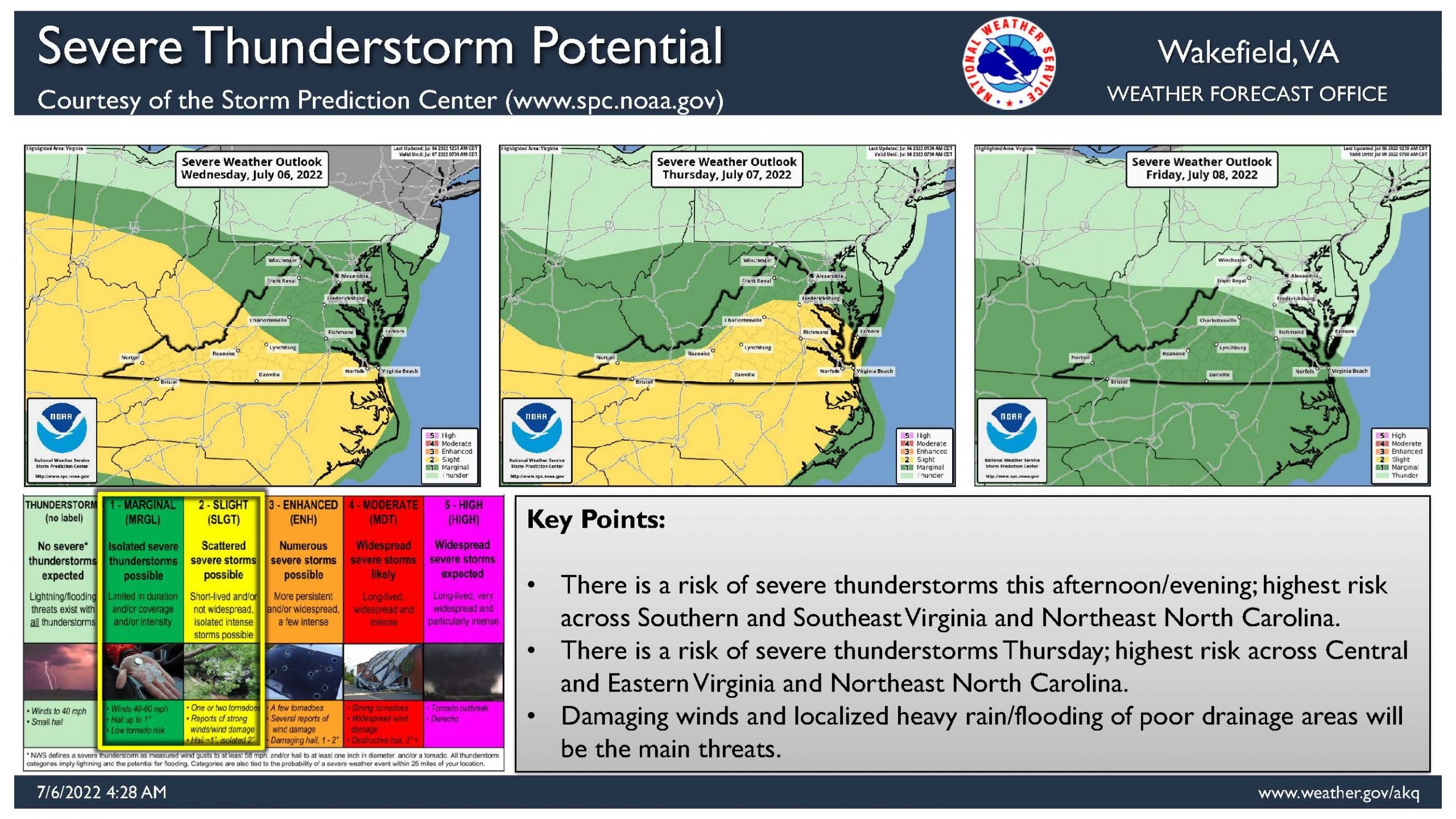
- Isolated to scattered strong to severe storms could result in areas of 50-70 mph wind gusts each day. Over the Bay and coastal waters expect winds of 40-50+ kt with any of the storms.
- Downed trees, as well as scattered power outages, are possible with the stronger storms. There is a very low probability of large hail and isolated tornadoes.
- Locally heavy rainfall can accompany stronger storms. Some locations may pick up over 1 inch of rain in a short period of time. This heavy rainfall could result in minor flooding of urban/poor drainage areas.
- The highest threat time for thunderstorms will be during each afternoon and evening. Everyone is urged to stay weather aware and have multiple ways to receive warnings.
Check Links Below For Updates:
Questions?
Call NWS at 757-899-5734
National Weather Service – Wakefield, VA
@NWSWakefieldVA facebook.com/